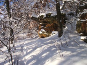
Friendship Center - Natural History of the Valley
The Driftless Area of Wisconsin is famous the world over because it is completely surrounded by glaciated territory. It preserves a large sample of what the rest of Wisconsin, as well as northern and eastern United States, were like before the Glacial Period.
A well known topographic feature in southwestern Wisconsin and eastern Iowa is popularly known as the Military Ridge. Friendship Center is nestled in a valley carved by meltwater from the surrounding glaciers and located just a few miles from the top of the ridge.
In Wisconsin it constitutes the divide between the north- flowing tributaries of the Wisconsin River and the south- flowing streams tributary to the Rock and Mississippi. Its crest was followed by the Military Road, built in 1835 from Green Bay to Prairie du Chien, by way of Fond du Lac, Portage and Blue Mounds. Doubtless the existence of the Military Road was responsible for the location of the territorial road between Milwaukee and the lead and zinc district soon after 1837. It came by way of Madison and joined the Miltary Road southeast of Mt Horeb. (Friendship Center is only a few miles down hill from the Military Ridge Road)..jpg)
Herbert Quick [described] the heyday of its use as a highway of immigration from Milwaukee and Madison to Dubuque, Iowa over the back slope of the Military Ridge.
"It was in the latter part of March. There were snow- drifts in places along the road, and when I reached a place about where Mt Horeb now is, I had to stop and lie up for three days for a snowstorm. I was ahead of the stream of immigrants that poured over that road in the spring of 1855 in a steady tide . . .
"As I went on to the westward, I began to see Blue Mound rising like a low mountain . . . , and I stopped at a farm in the foothills of the Mound where, because it was rainy, I paid four shillings for putting my horses in the stable.
. . . "I saw the old mining country from Mineral Pont to Dubuque, where lead had been dug for many years, and where the men lived who dug the holes and were called Badgers . . . ; and at last, I saw from its eastern bank far off to the west, the bluffy shores of Iowa, and down by the river the steep spires and brick and wood buildings of the biggest town I had seen since leaving Milwaukee, the town of Dubuque.
Adapted from: Lawrence Martin, The Physical Geography of Wisconsin, published by the University of Wisconsin Press, copyright © 1965 by the Board of Regents of the University of Wisconsin System.
Friendship Center and surrounding area is home to the endangered Ornate Box Turtle


.jpg)